What will urban life be like in post-pandemic public spaces and green areas?
Covid-19 pandemic called into question and highlighted the importance of green areas and urban public spaces
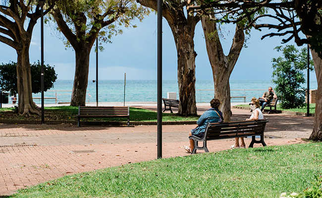
Image of Gabriella Clare Marino on Unsplash
The impacts caused by the Covid-19 pandemic have profound consequences on urban life, on people's daily habits and behaviors, and right now it is necessary to rethink the city we want to live. Faced with so many uncertainties, we see the opportunity to strengthen urban life with healthy environmental practices, which will not only add quality of life at the neighborhood scale, but will bring greater integration of man with nature and benefits to the environment, as cities they are the most vulnerable places in the face of climate change and need a new look in their planning.
The Covid-19 pandemic called into question and highlighted the importance of green areas and urban public spaces, in contrast to the social isolation to which we are all subjected, as the only vaccine available to prevent contamination. After some kind of flexibility in this difficult isolation, people are eager to enjoy the benefits of open spaces, in addition to returning to some kind of social interaction that is so important to our health. However, we will have to seek new social behavior protocols in order to be able to take advantage of green areas, and at the same time seek to expand access opportunities to green areas for all social segments. And often, as is the case in São Paulo, this access will necessarily imply the expansion of new public spaces (PSICAM ORG, 2020).
On the other hand, the functionalist city model with maximum constructive use, waterproofing of urban spaces, destruction of vegetation cover and canalization of rivers and streams is increasingly vulnerable and less resilient to climate change and its impacts - increased rainfall and risk of floods, landslides in risk areas due to the presence of exposed soils and slopes with risks of mass movement.
JACOBS (1961), with his criticism of the urbanistic ideology of modernism, the schematic separation of different land uses and the dizzying growth of car use, states that the result was lifeless, insecure and empty cities; and GEHL (2013) emphasizes the importance of urban planning and the rescue of the human dimension of cities to accommodate people in public spaces that are sufficient and designed on a human scale, in a pleasant and safe, sustainable and healthy way. Both outlined new paths to be explored to build sustainable cities.
In this sense, post-pandemic urban life can be rethought in order to value green areas in the city of São Paulo, which offer social, environmental, cultural, recreational, aesthetic and health benefits to the population. The expansion of green areas in public spaces will perform important functions for socio-environmental quality: leisure, public health, improvement in air quality, improvement in community coexistence, climate improvements, green corridors, creation of eco-neighborhoods; and it is present in people's sense of belonging to public spaces, community participation, increased social relationships, health and well-being.
The quarantine and social isolation at the global level imposed by the fight against the pandemic bring us a central reflection: how are we going to live together in public spaces in the post-pandemic?In this line of thought, we start from the assumption that a well-planned and monitored green grid can be a fundamental strategy in reconnecting people with nature, providing a strengthening of social resilience, responding to the needs of the community in an inclusive and healthy way, and in support environment of cities, as a means of regeneration of the urban fabric in the face of climate change, and with even greater importance and re-signification of the role of green areas in the city.
We can cite as a reference for good environmental practices of green areas in urban morphology the revitalization of the Cheong-Gye Stream in Seoul, South Korea. In the beginning of the 21st century, a central area of the city – inhospitable to urban life, with a polluted stream and buffered under an elevated road network, it had a radical transformation of the landscape. The implementation of a requalification plan and the creation of 6 km of linear park along the Cheong-Gye stream, open and unpolluted, provided the city with the main element of socio-environmental inclusion and new opportunities for leisure, culture and well-being for people .
The city's public spaces – streets, squares and parks, as well as underutilized spaces, alleys and urban voids – will be able to contribute to the formation of this network of green areas, connecting neighborhoods and providing social interaction with leisure, culture and sport activities. Among them, the following stand out: the increase in afforestation in the road system and wide tree-lined sidewalks (boulevards), as well as central flowerbeds with cycle paths and walking trails; the implementation of community gardens in small squares in neighborhoods, common areas of public schools, high voltage lines, or even in public facilities, such as the green roof of Centro Cultural São Paulo in São Paulo; the green paths (greenways), bringing the renaturalization of streams and rivers, with hiking trails and bike paths, such as the Parque das Corujas in Vila Madalena, in São Paulo.
According to GIORDANO (2004), linear parks are areas intended for both conservation and preservation of natural resources, with the main characteristic being the ability to interconnect forest fragments and other elements found in a landscape, as well as ecological corridors.
Linear parks can provide a space to strengthen democracy and become an important reference point for people in the post-pandemic period. Access to linear parks is public, generating possibilities for sports and recreation activities that are essential for the physical and mental health of citizens, generating social inclusion and bonding between communities belonging to different territorial boundaries, especially when they encompass a large extension of urban land.
We highlight the great environmental potential of linear parks as a direct mechanism to preserve protected areas and the ecosystem's own biodiversity, as well as the presence of green areas, which play a strategic role in climate change mitigation and adaptation initiatives. The planting of trees and conservation of vegetation in these areas contribute to the absorption of CO2, and, in addition, the mitigation of the effects of floods, as they can strengthen the structure of riverbeds. This role, in particular, makes linear parks strategic elements in climate policies in urban spaces, and seek complementarity with other policies (IDB, 2013).
Like Campinas, in its 2016 Campinas Municipal Green Plan, several municipalities outside Brazil have developed plans aimed at restoring the municipal environment; also called GreenPlan – ecological corridors, always keeping the issue of connectivity of plant fragments as the basis of the concept. (CAMPINAS, 2016).
The need to integrate not only green areas, but also the water network – streams and rivers – is perceived as a structuring element of the urban landscape, creating an integrated and sustainable connection for cities.
“The river has incredible potential to develop a green infrastructure. There are forested massifs, that is, with important fragments of the Atlantic Forest, which must be preserved. Biodiversity is extraordinary. Its landscape is the greatest asset, and in my view it should be the main focus of a planning that not only conserves, but also recovers as much as possible of its natural ecosystems. With this, Rio would have the potential to be the first “Green City” in Brazil, or rather, in Latin America (…).” (HERZOG, 2010; p. 157).
The streets and avenues of the city of São Paulo may have great potential as green corridors – scenarios that act as conduits and habitat for animal and plant species adapted to the urban environment, as well as a healthy connection between parks, squares and free spaces for people take ownership in a dynamic way with walkability.
Urban parks need to be reopened with priority in relation to closed activities, with sanitary security measures to preserve people's health, and with a strategy of use adequate to the support capacity – referring to the number of people per useful area of each park. At Domino Park, in New York, areas of use were defined in the shape of circles on the lawn, limiting the number of people per group, to ensure a safe distance.
Another important scenario to be explored are open spaces connected to the road network of green corridors - the parklets – areas adjacent to sidewalks, where structures are built in order to create spaces for leisure and conviviality where previously there were parking spaces for cars, and small green areas in the neighborhoods (PDE 2002 and PDE 2014, SP).
Strengthen the resumption of the implementation of linear parks provided for with the environmental water network, defined in the Strategic Master Plan – PDE-2014 – Law 16.050/2014 of the Municipality of São Paulo in Art. 24 and in the Guidelines for Regional Plans for Subprefectures (Decree No. 57,537 , of December 16, 2016).
The green areas distributed in an equitable way in the territory will allow quick access of citizens to their benefits, closer to their places of residence and/or work, particularly in this new normal brought by the post-pandemic scenario or coexistence with new pandemic waves , so that we can safely enjoy these spaces, which point to a more sustainable, resilient, inclusive and solidary city.
Bibliographical references: IDB – Interamerican Bank of Desarrollo, Mora N. M. Experiences of linear parks in Brazil: Multifunctional spaces with the potential to offer alternatives to drainage and urban water problems. TECHNICAL NOTE # IDBTN-518, 2013. Available at publications.iadb.org/publications/portuguese/document/Experi%C3%Ancias-de-parques-lineares-no-Brasil-espa%C3%A7os-multifunctional-com-o -potential-to-offer-alternatives-to-drainage-problems-and-%C3%Water-urban.pdf CAMPINAS. Green Municipal Plan. Prognostics. Campinas City Hall. 2016. GEHL Jan. city for people. Publisher Perspective. 2013 GIORDANO, Lucília do Carmo. Analysis of a set of methodological procedures for the delimitation of green corridors (greenways) along river courses. Doctoral thesis. Institute of Geosciences and Exact Sciences, São Paulo State University, Rio Claro, 2004. HERZOG, Cecilia P.; ROSE, Lourdes Zunino. Green Infrastructure: Sustainability and Resilience for the Urban Landscape. LABVerde Magazine FAUUSP, São Paulo no. 1, Oct 2010, pp. 91–115/157-161. JACOBS J. Death and Life of Big Cities. Publisher Martins Fontes. 2011. SÃO PAULO (city). City Hall of São Paulo. Strategic Master Plan, São Paulo – Law No. 13430 of September 13, 2002. In cm-sao-paulo.jusbrasil.com.br/legislacao/813196/lei-13430-02 SÃO PAULO (city). City Hall of São Paulo. LAW No. 16.050 OF JULY 31, 2014. Strategic Master Plan. In gestaourbana.prefeitura.sp.gov.br/arquivos/PDE_lei_final_aprovada/TEXTO/2014-07-31%20-%20LEI%2016050%20-%20PLANO%20DIRETOR%20ESTRAT%C3%89GICO.pdf. Accessed on 06/01/2020. PSYCHOMB.ORG. ASOCIACIÓN DE PSICOLOGÍA ENVIRONMENTAL. Guidelines for being at home. Psychology of space. 2020. Available at: psicamb.org/index.php?lang=pt. Accessed on 06/01/2020.